Products / Spatial Air Quality
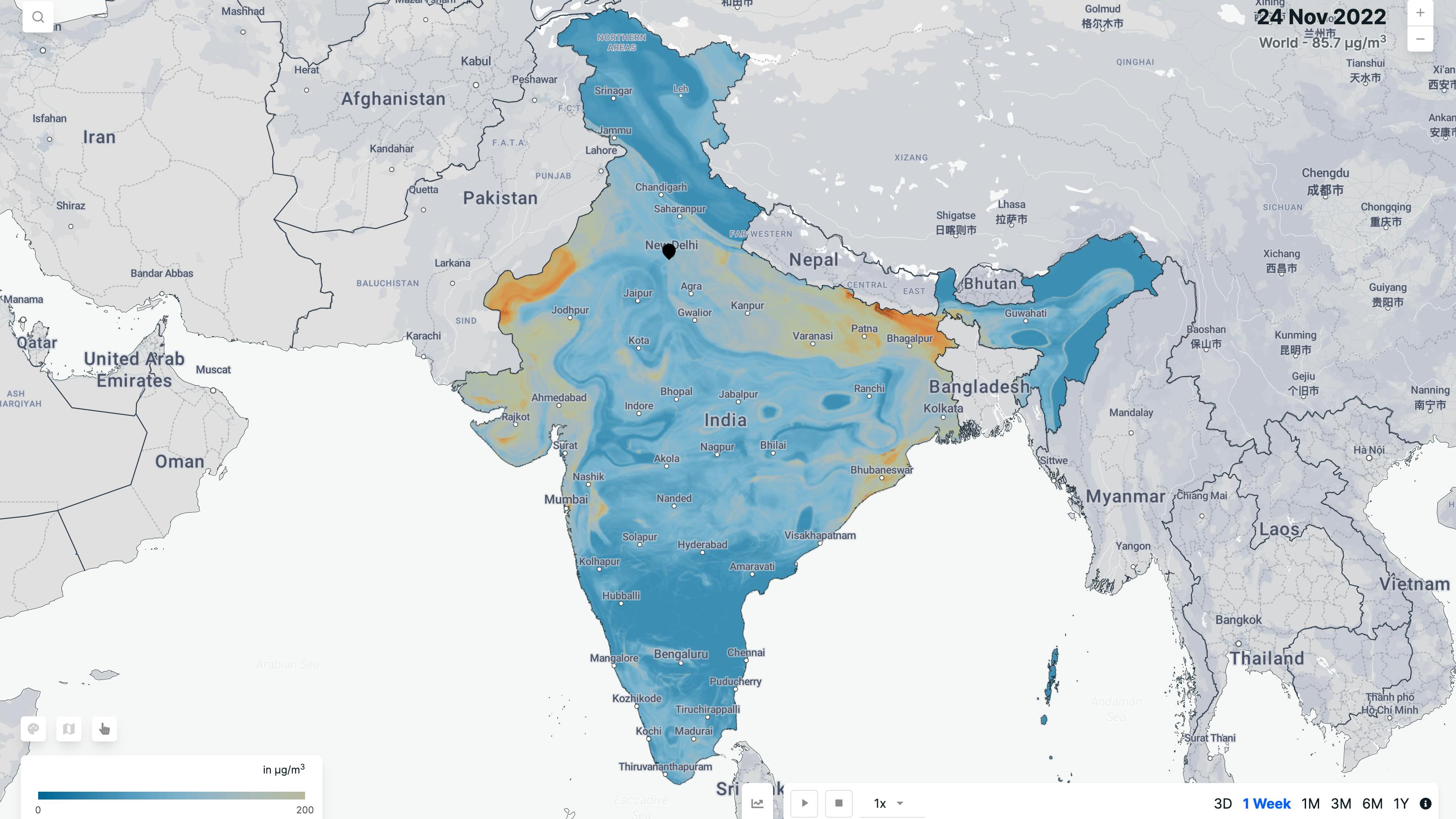
Spatial AQ is a pan-India air quality dataset derived using satellite data, CPCB monitors and machine learning models. It offers a comprehensive view of air quality over the Indian Sub-Continent, as satellites can cover large areas and track the movement of pollutants over time. Spatial AQ is India's most extensive air quality data, with 3.3 million points that our model estimates daily compared to ~ 300 ground sensors.
Ground sensors are useful for monitoring air quality at a specific location. Still, their coverage is limited and primarily found in major cities due to the high costs associated with setting up & maintenance. Satellites, on the other hand, can track the movement of pollutants over time and provide data over a large area. Despite being a useful tool for monitoring air quality, they have some limitations as they can only provide a broad overview of air quality and may not be able to capture detailed information about air quality at the ground level. Spatial AQ combines satellite data with ground-based measurements, that help to overcome these limitations and provide a comprehensive understanding of air quality.
Parameters
PM 2.5
PM2.5 (particulate matter with a diameter of 2.5 micrometers or less) is a type of air pollutant that consists of small, fine particles that are suspended in the air. These particles are so small that they can be inhaled into the lungs and cause a variety of health problems, including respiratory and cardiovascular diseases.
Features
Methodology
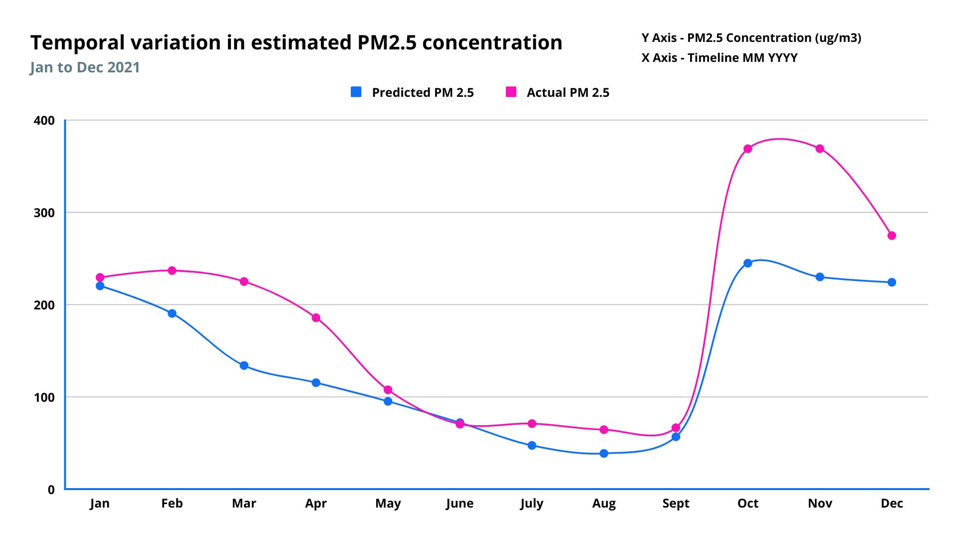
The PM 2.5 levels are calculated using machine learning models trained over years of real-time Air Quality measurements collected from more than 300 Central Pollution Control Board (CPCB) Air Quality monitors and near real-time satellite data products, including aerosol optical depth (AOD) & weather parameters.
Blogs
Frequency
Daily
Spatial resolution
1 kilometer
Coverage
India
Data type
Raster
Availability


